
Bryn Gilwern
Bryn Gilwern
Promoter: Bute Energy
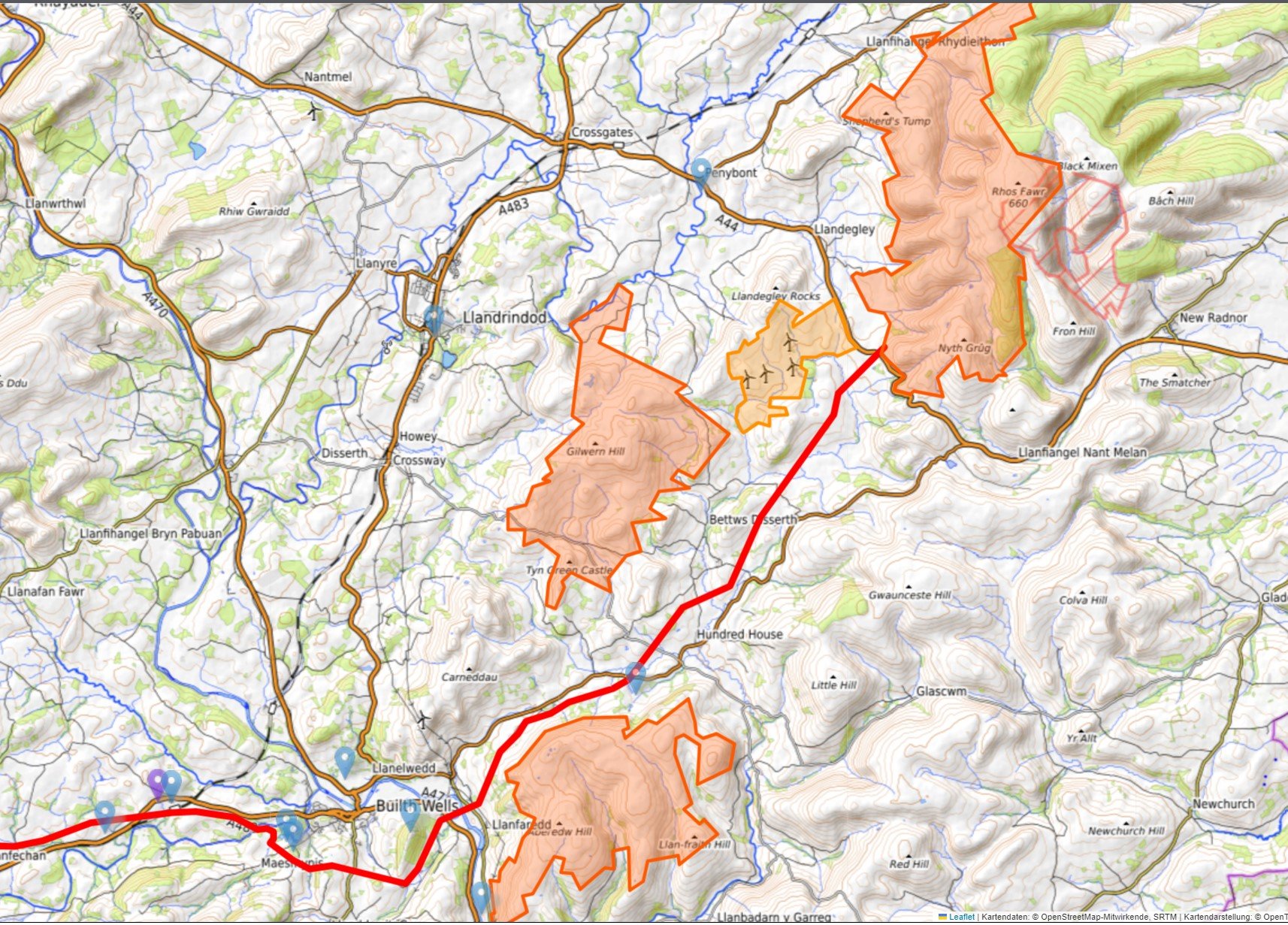
Location: 4 km south east of Llandrindod Wells
Capacity: 84 MW - 16 turbines 220 metres tall
Timeline:
Winter 2023: current phase. Non-statutory consultation with communities, stakeholders and consultees 6 weeks
Winter 2023 - autumn 2024: Evaluating and considering feedback received to progress the project design
Summer 2024: Meteorological Mast Installation (nb, this assumes planning permission, not mentioned.)
Throughout 2024: Design development, EIA and reporting
Spring 2025: Statutory pre-application consultation with communities, stakeholders and consultees
Summer 2025: Submission of DNS application
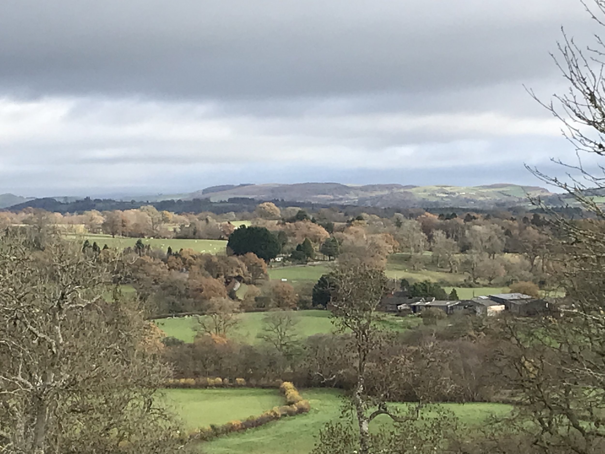
Comments: Gilwern Hill is a hill about 3 miles southeast of Llandrindod Wells in the old county of Radnorshire, now Powys. It is open moorland, fringed with dry stone wall enclosures and crossed by ancient trackways trodden by Welsh cattle drovers, driving cattle to English markets. From Gilwern there are incredibly beautiful views of the Welsh countryside, from the Radnor Forest to Mynydd Eppynt.
Bute Energy intends to build a huge wind farm, stretching northwards from the southern edge of Castle Bank to Cwmbrith, and encompassing Gilwern Hill common. Most of the 16 turbines are planned for fields owned privately and will be positioned close to the still not turning turbines of Hendy Wind Farm. The positions of a battery storage unit and a sub station are being discussed with individual landowners and Bute has attempted to agree contracts for the 60 mile pylon route that it says is required. Currently one 725 foot turbine is proposed to be positioned on the common overlooking Frank’s Bridge. Gilwern Hill Common is owned by the Legge Bourke family which is keen to sell the land but a number of graziers have traditional common land rights to the unenclosed hill (https://www.dailymail.co.uk/news/article-12495371/Wales-wind-farm-villagers.html). Bute has also proposed an access track of up to 100m wide, which will scar the hill and landscape forever. There is no promise that more turbines will not be built on the hill.
The hill forms a part of the Builth Inlier, an area of international paleontological significance. There are many ancient monuments across the hill and in landowner’s fields, assessed to be of national importance for their potential to enhance knowledge of prehistoric burial and rituals. Bronze Age burial cairns and stone rows have been identified, as well as the possibility of a stone circle. Castle Bank is a fine and well preserved hillfort, which probably dates to the Iron Age and retains considerable archeological potential. Numerous house platforms can be identified from aerial photographs. At Pant-y-Rhiw there is a deserted medieval rural settlement, including a house platform and surrounding enclosure. Upper House has a post-medieval platform house.
Many birds are spotted on the hill each year, including the Wheatear, Reed Buntings, Stonechats, Skylarks, Curlew, Jack Snipe and of course, Red Kites.